
Photo Map 1.2 is now available to download on the App Store! This is a packed update that includes over 80 new maps, great new features, and a rethought business model based on feedback from the launch back in August.
Maps for 31 new countries
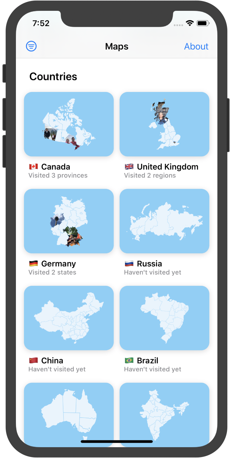
When I launched Photo Map, it only included maps for three countires: the United States, Canada, and Australia. I picked them because they’re fairly large countires with large sub-regions. After all, US States are about the size of whole European countries. Photo Map really struck a chord with a lot of users from around the world, though, who wanted to be able to use it with their own home country.
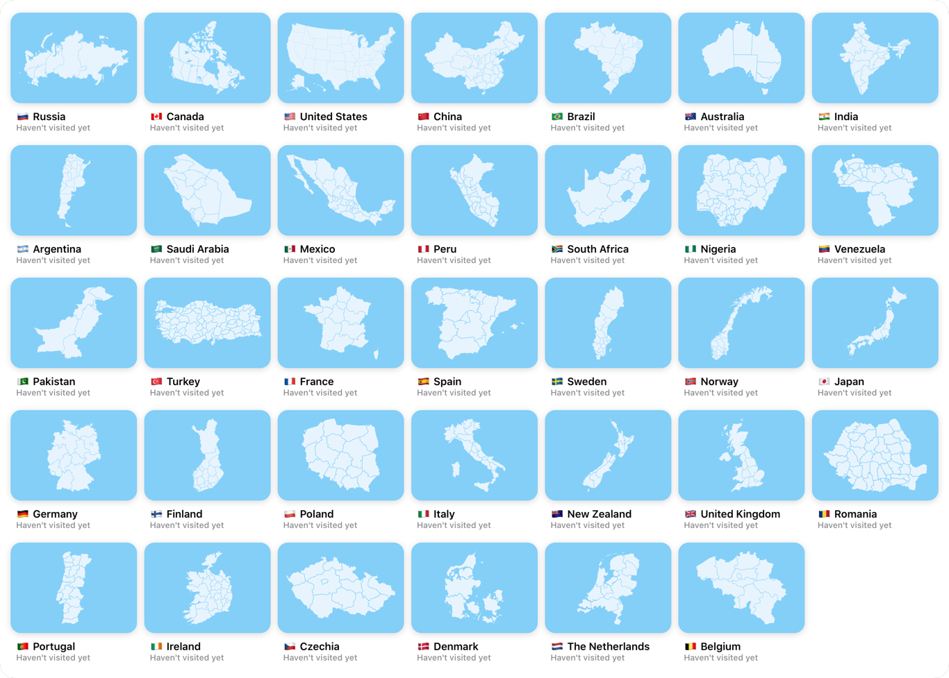
I was linked to a GitHub repo with TopoJSON files for the sub-regions of dozens of World Countries. I just had to slice and dice the data with Mapshaper to turn it into the GeoJSON format that Photo Map uses. Thanks to these great tools, Photo Map now has maps for 34 countries from around the world. This includes highlights like China, Brazil, India, Mexico, France, and Germany, but there are plenty of others for you to enjoy as well.
Maps for the 50 US States
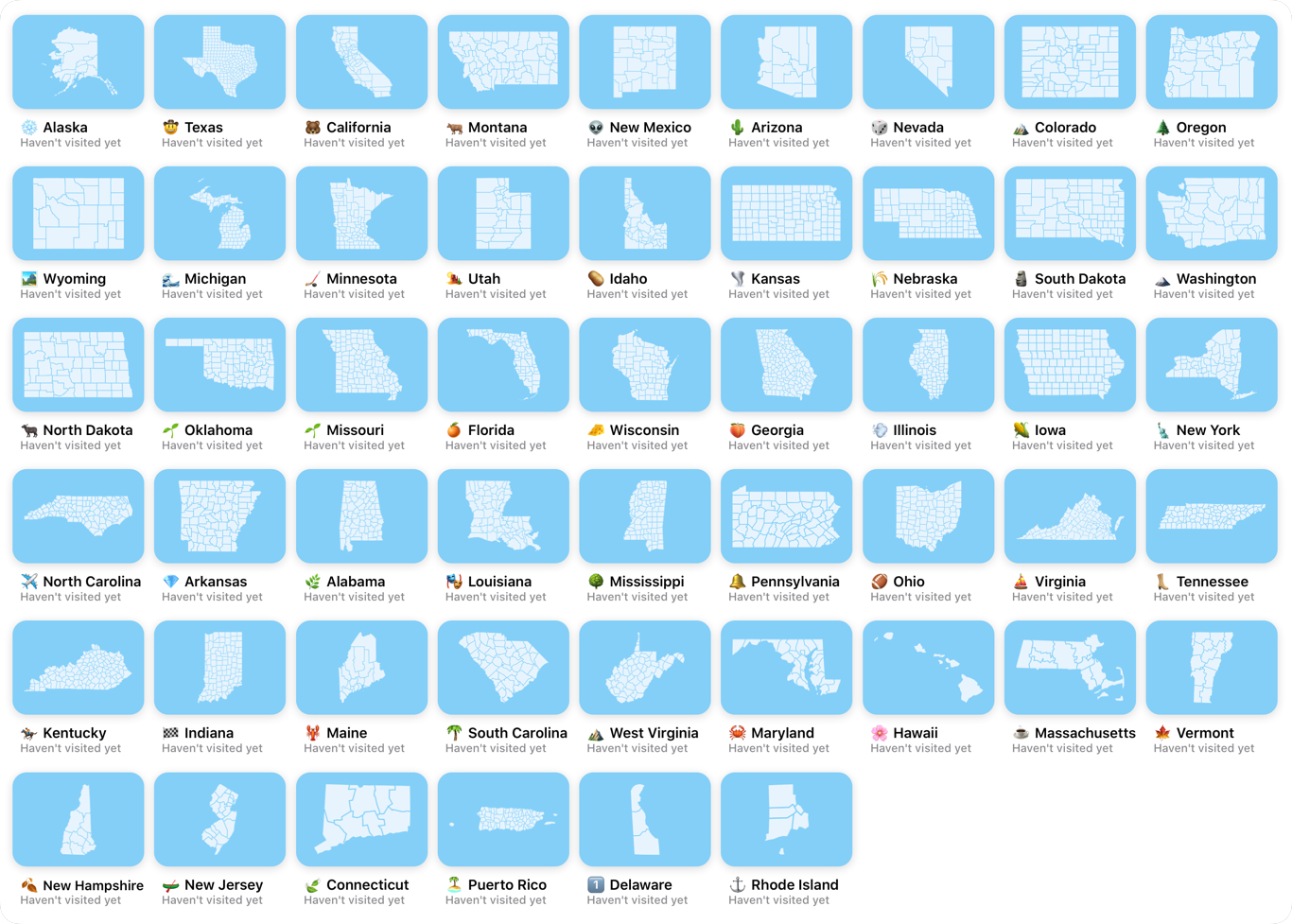
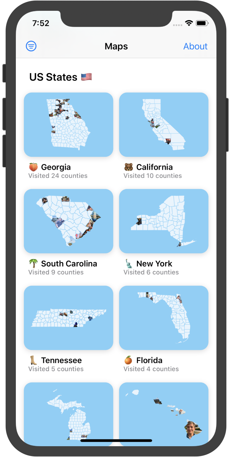
I was soliciting country requests on Twitter, and my friend Logan cheekily requested support for the Counties of Georgia. The TopoJSON repo I was using happened to also have counties data for all 50 of the US States, so I couldn’t resist. All content is good content! (The hardest part with this was actually trying to choose a unique emoji for each of the 50 states. It wasn’t easy!)
You should add county maps for people who DONT travel that much. Let me see my photos in Richmond county, Clarke county, Dekalb county, you know, the good stuff
— L🕸G🕷N M🦇E🔪R💀Y (@loganjmcelroy) September 25, 2019
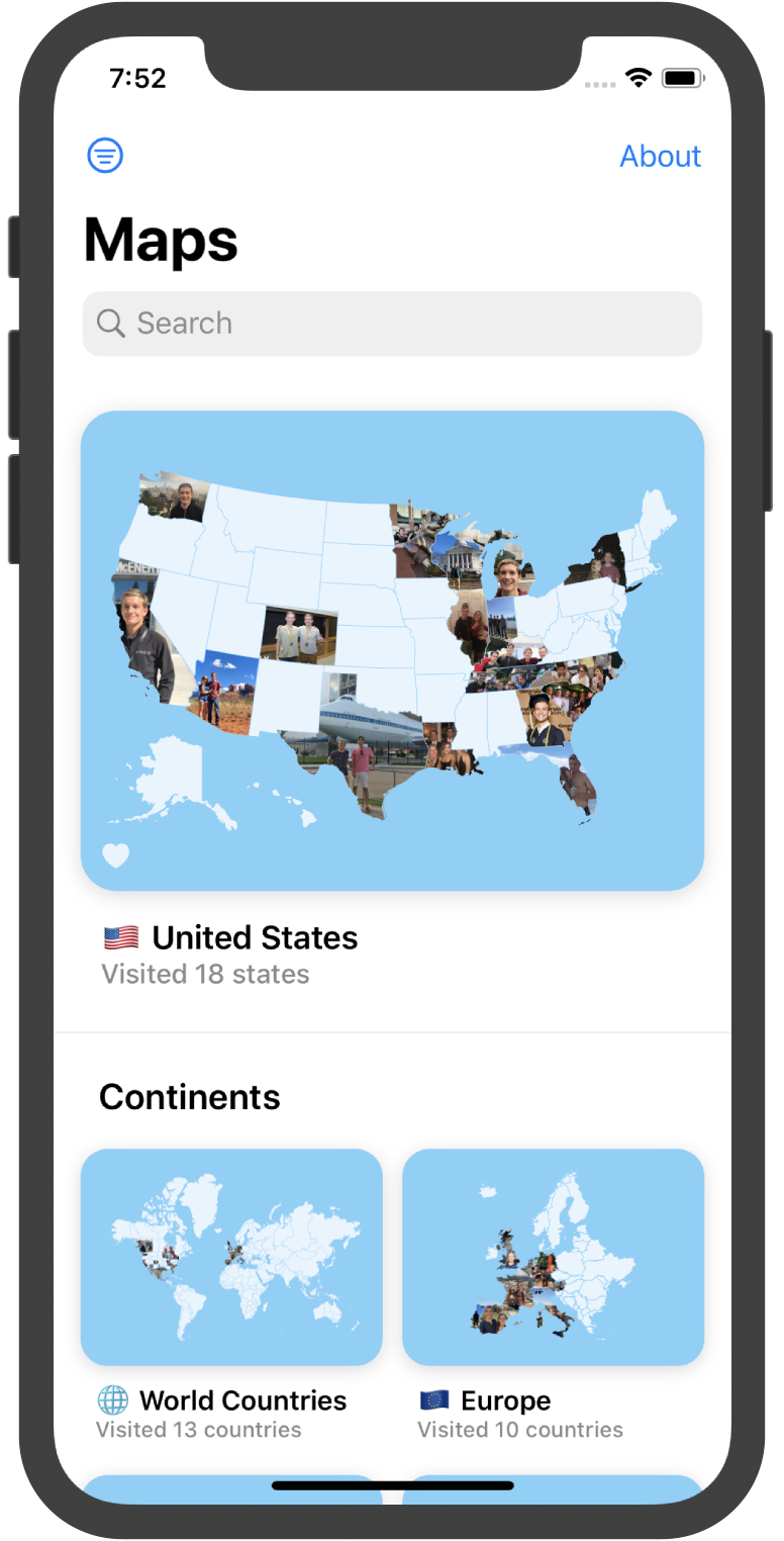
Redesigned Map List with Search
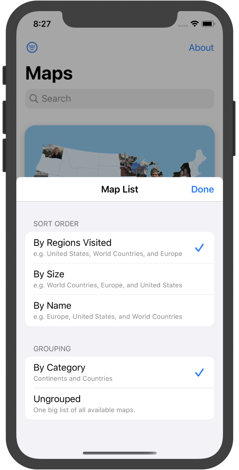

Photo Map 1.0 only included 8 maps, so the Map List could afford to be fairly simple. Photo Map 1.2 now includes over 90 maps, so the old layout wasn’t cutting it anymore. I reworked the Map List to use a two-column layout and group the maps into categories (currently “Continents”, “Countries”, and “US States”). You can set Favorite maps that always appear at the top, and you can pick between several different options for sorting the growing list of maps. If you want to pull up a specific map, you can also now search for it by name.
Updates to the Explorer Pack
In Photo Map 1.0, all users got the United States map for free. This was definitely not the greatest strategy for non-US users, who were basically unable to use Photo Map at all if they hadn’t been to the US before. I’ve re-worked it a bit in Photo Map 1.2, and now users get a free map that’s more tailored to their home country.
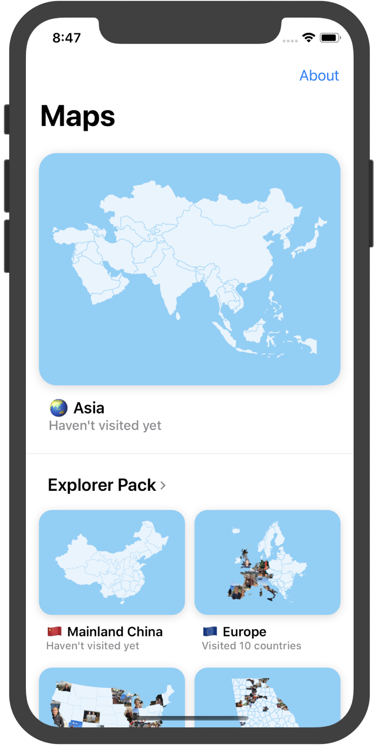
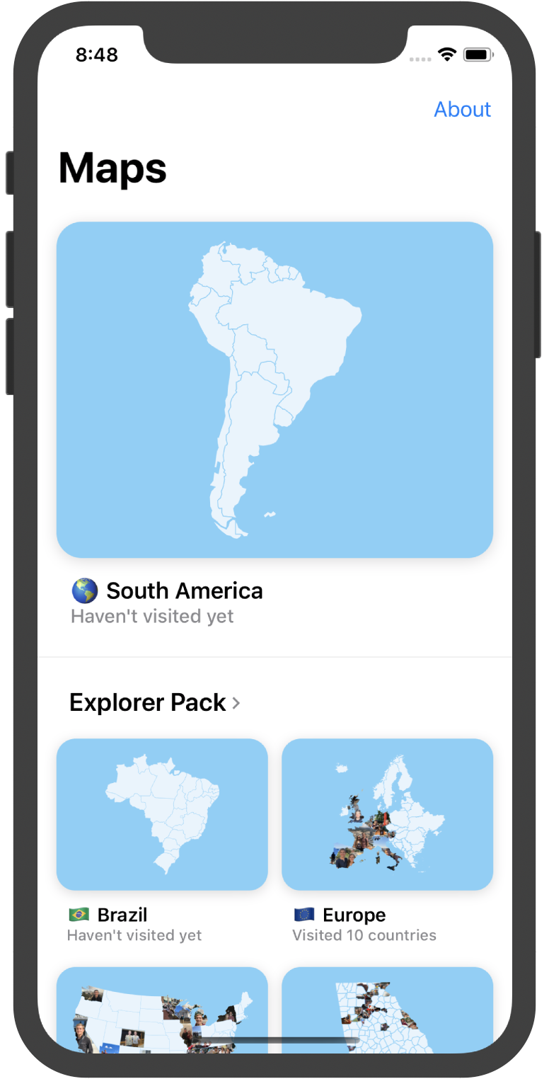
Users from the US will continue to get the United States map for free, but users from other countries will now get their home continent for free. Photo Map also highlights some specific Explorer Pack maps that the user may find interesting, such as the map for their home country, their most-visited continent, etc. I’m hoping that these new changes will help make the app feel less US-centric (a common complaint on the App Store reviews) while also helping to increase conversion for the Explorer Pack.
Great iOS 13 Support
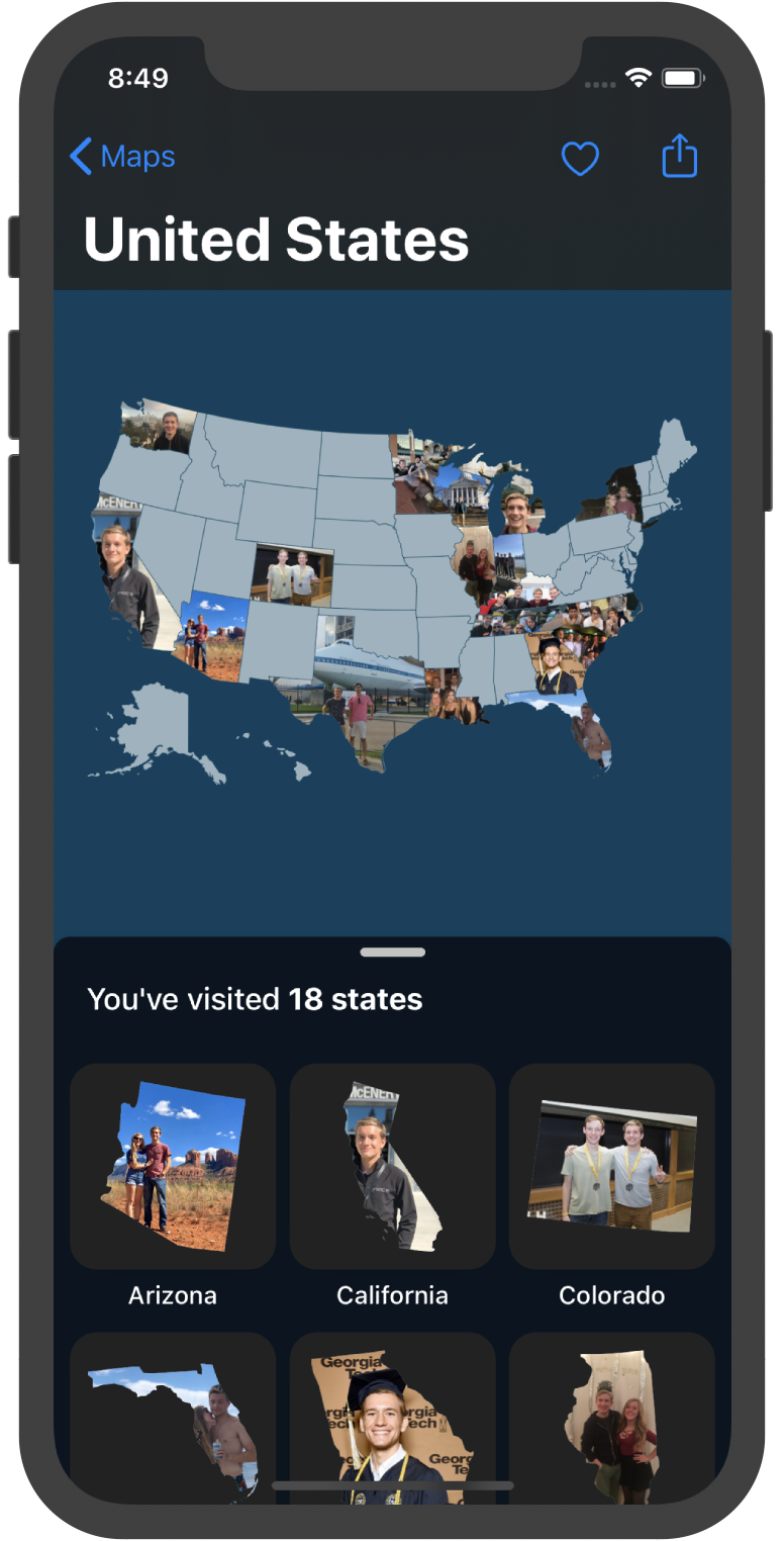
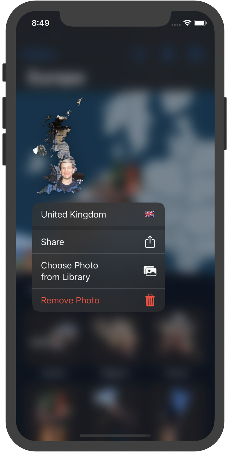
Photo Map also now has great support for the new features introduced in iOS 13. Photo Map 1.1 added support for Dark Mode and Context Menus throughout the app, and takes advantage of the system’s new design language.
Downloading Photo Map
Photo Map is available to download on the App Store for iPhone and iPad!